
- Home
- Forecast
- Radar
- Maps
- WX-Data
- WX-Misc.
- Astronomy
- Fire
- About
- Links
 Air Quality
Radar |
") |
| Advisories / Alerts |
| Severe Wx Summary! | ||||||
 |
||||||
|
||||||
|
||||||
 |
||||||
| Tue, Apr 23, 2024 - 2:31am | ||||||
|
|
|
|
|
|
| Today's Forecast Map |
| Color Satellite |
| Info Links | |
| Live NOAA Weather Radio |
 |
|
|

| La Niña / El Niño Index |
| Past 48 months graph |
| Past 10 Years graph |
| 1950 to Present graph |
| 1950 to Present Text |
| Synopsis and more |
| Water Temp Map |
|
")
| Free Web Stickers |
| Forecast Search |


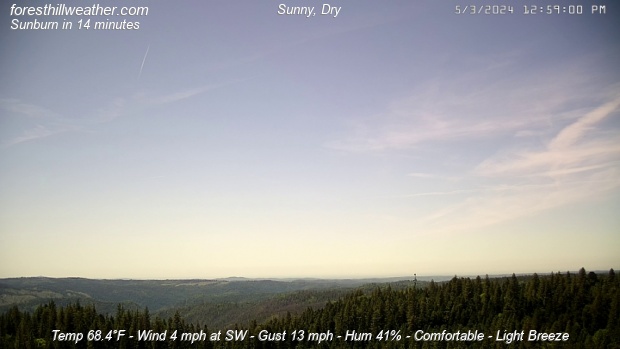
| Weather Conditions Clear skies, Dry Visibility: 10 miles |
|
|
This Icon is a Combination of Blue Canyon Airport and Data From foresthillweather.com |
|
Visibility: 10 miles
Summary / Temperature ![]()

53.9°F

")
54.5°F

55.9°F/ 13.3°C
Temp Rate:
24/hr Difference:
Avg Running Temp:
Todays High:
Todays Low:
Y-days High:
Y-days Low:
Todays WChill:
Y-days WChill:
Evapotranspiration:
-1.3°F/hr ![]()
-4.5°F ![]()
56.2°F
58.1°F 12:00am
54.4°F 2:36am
81.3°F 2:56pm
56.8°F 6:50am
53.1°F 2:22am
53.2°F 6:56am
0.000 in
Pool water Temperature ![]()
Temperature:
Pool Temp VRS Out Temp:
Avg Running Temp:
Todays High:
Todays Low:
Y-days High:
Y-days Low:
59.0°F
+4.6°F ![]()
59.0°F
59.0°F 12:00am
59.0°F 12:00am
59.0°F 1:26pm
57.0°F 9:25am
24hr Pool Temperature Graph 10 day Pool Temperature Graph Wind ![]()

Calm
Gusting to
2.0 mph

219° SW

Avg speed:
Wind Run:
Peak Gust:
0.3 mph ![]()
2.0 miles
7 mph 2:19am
Almanac ![]()

Illuminated 14 days in cycle
Moonrise:
Moonset:
Sunrise:
Sunset:
Solar Noon:
7:55pm
5:58am
6:12am
7:46pm
1:02pm
Solar Radiation ![]()
Rain
Rain Today:
Rain Rate (/hr):
Rain last hour:
Rain Yesterday:
This Month:
Season Total:
8 Days Since Last Rain Day
0.00 in
0.000 in
0.00 in
0.00 in
1.32 in
45.75 in
Updated Time
Updated: 4/23/24 2:37am
(Updated sec ago)
Humidity & Barometer
Humidity:
Wetbulb:
Dew Point:
Barometer:
80% ![]()
51.2°F
48.4°F ![]()
29.785 inHg ![]()
| Northern Calif Preparedness |
|
| Fire Level |
|
UV Index ![]()
0.0 None
0.0 None
Overnight Slight Chance Rain Showers |
Tuesday Slight Chance Rain Showers then Sunny |
Tuesday Night  Mostly Clear |
Wednesday Mostly Sunny |
Wednesday Night  Partly Cloudy |
Thursday Mostly Sunny |
| Lo 50 °F | Hi 65 °F ↓ | Lo 46 °F | Hi 63 °F | Lo 45 °F | Hi 58 °F |


Foresthill Probe 2 Stats ![]()
Foresthill Probe 2: is located on Thomas Street
at 3000 feet. The main Foresthill Weather site
is located on Melody ln at the 2860 foot elevation
-1.3°F
83%

| Updated: 23/04/24 - 02:35:30 | |
| Todays High: | 56.9°F 00:00 |
| Todays Low: | 53.6°F 02:31 |
| Rain Today: | 0.00 in |
| Season Total: | 43.60 in |
Foresthill Wx: Monthly,Yearly, Highs and Lows ![]()
|
||||||||||
|
||||||||||
|
||||||||||
|
||||||||||
|
||||||||||
|
||||||||||
|
||||||||||
|
||||||||||
|
||||||||||

")
")
")
")
")
; "Satellite Imagery Sacramento,CA. (click to enlarge)")
| NWS Weather Forecast - Summary | ||||||||||||||||
|
||||||||||||||||
| NWS Weather Forecast: Overnight and Tuesday (Updated: Tue, 23-Apr-2024 12:01am PDT) | |||||
|
|
||||
| NWS Weather Forecast - Summary | ||||||||||||||||
|
||||||||||||||||
| Wunderground Forecast: Tonight and Tomorrow | |||||
|
|
||||
| Data Compliments of Weather Underground | |||||
| NOAA Local Storm Report | |||||
| 1 MILE SOUTH-SOUTHWEST OF Sullivan ( More ) | |||||
| DATE 04/18/2024 |
TIME 10:00 PM |
COUNTY Sullivan |
STATE IN |
GEOGRAPHIC 39.08N 87.42W |
SOURCE 911 Call Center |
| Tstm Wnd Gst ESTIMATED AT 60 MPH | |||||
| NOAA Local Storm Report | |||||
| Vincennes ( More ) | |||||
| DATE 04/18/2024 |
TIME 10:08 PM |
COUNTY Knox |
STATE IN |
GEOGRAPHIC 38.68N 87.51W |
SOURCE Emergency Mngr |
| Tstm Wnd Dmg | |||||
| starting to get reports of trees and utility lines down within vincennes. | |||||
| NOAA Local Storm Report | |||||
| 3 MILES SOUTH-SOUTHWEST OF Vincennes ( More ) | |||||
| DATE 04/18/2024 |
TIME 10:13 PM |
COUNTY Knox |
STATE IN |
GEOGRAPHIC 38.64N 87.53W |
SOURCE Emergency Mngr |
| Tstm Wnd Dmg | |||||
| report of a semi overturned on us 41 near vincennes. | |||||
| NOAA Local Storm Report | |||||
| Bicknell ( More ) | |||||
| DATE 04/18/2024 |
TIME 10:13 PM |
COUNTY Knox |
STATE IN |
GEOGRAPHIC 38.78N 87.31W |
SOURCE Emergency Mngr |
| Tstm Wnd Gst ESTIMATED AT 60 MPH | |||||
| NOAA Local Storm Report | |||||
| 1 MILE NORTH OF Pimento ( More ) | |||||
| DATE 04/18/2024 |
TIME 10:15 PM |
COUNTY Vigo |
STATE IN |
GEOGRAPHIC 39.33N 87.39W |
SOURCE Amateur Radio |
| Tstm Wnd Dmg | |||||
| 11419 sugar lane about 6 miles south of terre haute.... Several large trees down. | |||||
| NOAA Local Storm Report | |||||
| 3 MILES WEST OF Lyons ( More ) | |||||
| DATE 04/18/2024 |
TIME 10:23 PM |
COUNTY Greene |
STATE IN |
GEOGRAPHIC 38.99N 87.14W |
SOURCE Public |
| Tstm Wnd Dmg | |||||
| tree down across 1050w west of lyons. | |||||
| NOAA Local Storm Report | |||||
| 3 MILES SOUTH OF Solsberry ( More ) | |||||
| DATE 04/18/2024 |
TIME 10:39 PM |
COUNTY Greene |
STATE IN |
GEOGRAPHIC 39.04N 86.75W |
SOURCE Public |
| Tstm Wnd Dmg | |||||
| multiple tree limbs and branches downed along state route 54 near eastern greene middle school. | |||||
| NOAA Local Storm Report | |||||
| 3 MILES EAST OF Odon ( More ) | |||||
| DATE 04/18/2024 |
TIME 10:40 PM |
COUNTY Daviess |
STATE IN |
GEOGRAPHIC 38.85N 86.93W |
SOURCE Public |
| Hail ESTIMATED AT 0.70 Inch | |||||
| NOAA Local Storm Report | |||||
| 4 MILES WEST-SOUTHWEST OF Columbus ( More ) | |||||
| DATE 04/18/2024 |
TIME 11:45 PM |
COUNTY Bartholomew |
STATE IN |
GEOGRAPHIC 39.18N 85.99W |
SOURCE Public |
| Tstm Wnd Dmg | |||||
| a live, well established pine tree was snapped at its base in a neighborhood in the tipton lakes area. | |||||
| How Close Are We To this Month's Temperature Record? Updated Tuesday, Apr 23, 2024- 2:35:01 AM Current Temperature: 54.4°F |
| April's High: Temperature Record 84.0°F - Set on Fri, Apr 28, 2023 - 2:09:11 PM We are currently 29.6°F |
| April's Low: Temperature Record 27.2°F - Set on Mon, Apr 3, 2023 - 7:16:06 AM We are currently 27.2°F |
| Records began on 03 November 2011 |
Weather History April 23, 2024
|


Ambient Weather VWS v14.00 Weather-Display (10.37S-(b58))
Virtual VP software Top Website Map Copyright © 2007 - 2024 Foresthillweather.com Never base important decisions on this or any weather information obtained from the Internet