
- Home
- Forecast
- Radar
- Maps
- WX-Data
- WX-Misc.
- Astronomy
- Fire
- About
- Links
 Air Quality
Radar |
") |
| Advisories / Alerts |
| Severe Wx Summary! | ||||||||
 |
||||||||
|
||||||||
|
||||||||
 |
||||||||
| Fri, Apr 19, 2024 - 4:41pm | ||||||||
|
|
|
|
|
|
| Today's Forecast Map |
| Color Satellite |
| Info Links | |
| Live NOAA Weather Radio |
 |
|
|

| La Niña / El Niño Index |
| Past 48 months graph |
| Past 10 Years graph |
| 1950 to Present graph |
| 1950 to Present Text |
| Synopsis and more |
| Water Temp Map |
|
")
| Free Web Stickers |
| Forecast Search |


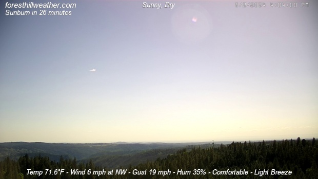
| Weather Conditions Sunny, Dry Visibility: 10 miles |
|
|
This Icon is a Combination of Blue Canyon Airport and Data From foresthillweather.com |
|
Visibility: 10 miles
ALERT: Geomagnetic K-index of 7
Summary / Temperature ![]()

71.0°F


73.4°F

74.9°F/ 23.8°C
Temp Rate:
24/hr Difference:
Avg Running Temp:
Todays High:
Todays Low:
Y-days High:
Y-days Low:
Todays HeatIdx:
Max Humidex:
Evapotranspiration:
0°F/hr ![]()
+1.6°F ![]()
73.8°F
74.7°F 2:48pm
52.7°F 6:31am
73.1°F 1:47pm
51.0°F 6:22am
75.0°F 2:48pm
77.9°F/ 25.5°C
0.157 in
Pool water Temperature ![]()
Temperature:
Pool Temp VRS Out Temp:
Avg Running Temp:
Todays High:
Todays Low:
Y-days High:
Y-days Low:
55.0°F
-18.2°F ![]()
55.0°F
56.0°F 4:07pm
54.0°F 12:00am
55.0°F 6:32pm
53.0°F 4:44am
24hr Pool Temperature Graph 10 day Pool Temperature Graph Wind ![]()

8.0 mph
Gusting to
10.0 mph

312° NW

Avg speed:
Wind Run:
Peak Gust:
3.4 mph ![]()
47.0 miles
16 mph 7:20am
Almanac ![]()

Illuminated 11 days in cycle
Moonrise:
Moonset:
Sunrise:
Sunset:
Solar Noon:
3:56pm
4:37am
6:17am
7:42pm
1:02pm
Solar Radiation ![]()
529 W/m2 (81%)
919 W/m2@12:44pm

Rain
Rain Today:
Rain Rate (/hr):
Rain last hour:
Rain Yesterday:
This Month:
Season Total:
4 Days Since Last Rain Day
0.00 in
0.000 in
0.00 in
0.00 in
1.32 in
45.75 in
Updated Time
Updated: 4/19/24 4:41pm
(Updated sec ago)
Humidity & Barometer
Humidity:
Wetbulb:
Dew Point:
Barometer:
42% ![]()
60.0°F
48.7°F ![]()
29.907 inHg ![]()
| Northern Calif Preparedness |
|
| Fire Level |
|
UV Index ![]()
3.0 Medium
7.6 High
| This Afternoon  Sunny |
Tonight Mostly Clear |
Saturday Sunny |
Saturday Night Mostly Clear |
Sunday Sunny |
Sunday Night Mostly Clear |
| Hi 71 °F ↓ | Lo 52 °F | Hi 71 °F ↓ | Lo 50 °F | Hi 73 °F | Lo 52 °F |


Foresthill Probe 2 Stats ![]()
Foresthill Probe 2: is located on Thomas Street
at 3000 feet. The main Foresthill Weather site
is located on Melody ln at the 2860 foot elevation
-0.3°F
47%

| Updated: 19/04/24 - 16:40:33 | |
| Todays High: | 72.4°F 14:14 |
| Todays Low: | 50.4°F 06:32 |
| Rain Today: | 0.00 in |
| Season Total: | 43.60 in |
Foresthill Wx: Monthly,Yearly, Highs and Lows ![]()
|
||||||||||
|
||||||||||
|
||||||||||
|
||||||||||
|
||||||||||
|
||||||||||
|
||||||||||
|
||||||||||
|
||||||||||

")
")
")
")
")
; "Satellite Imagery Sacramento,CA. (click to enlarge)")
| NWS Weather Forecast - Summary | ||||||||||||||||
|
||||||||||||||||
| NWS Weather Forecast: This Afternoon and Tonight (Updated: Fri, 19-Apr-2024 11:22am PDT) | |||||
|
|
||||
| NWS Weather Forecast - Summary | ||||||||||||||||
|
||||||||||||||||
| Wunderground Forecast: Tonight and Tomorrow | |||||
|
|
||||
| Data Compliments of Weather Underground | |||||
| NOAA Local Storm Report | |||||
| 2 MILES SOUTH OF MATOAKA ( More ) | |||||
| DATE 04/15/2024 |
TIME 9:43 PM |
COUNTY MERCER |
STATE WV |
GEOGRAPHIC 37.39N 81.24W |
SOURCE PUBLIC |
| HAIL MEASURED AT 0.75 INCH | |||||
| NOAA Local Storm Report | |||||
| 2 MILES SOUTH-SOUTHEAST OF MATOAKA ( More ) | |||||
| DATE 04/15/2024 |
TIME 9:47 PM |
COUNTY MERCER |
STATE WV |
GEOGRAPHIC 37.39N 81.23W |
SOURCE TRAINED SPOTTER |
| HAIL MEASURED AT 1.00 INCH | |||||
| NOAA Local Storm Report | |||||
| 1 MILE EAST OF FLATWOOD ( More ) | |||||
| DATE 04/16/2024 |
TIME 2:10 PM |
COUNTY ASHE |
STATE NC |
GEOGRAPHIC 36.55N 81.61W |
SOURCE PUBLIC |
| HAIL MEASURED AT 0.25 INCH | |||||
| report of pea sized hail on tucker road. | |||||
| NOAA Local Storm Report | |||||
| 2 MILES EAST OF BEECH MOUNTAIN ( More ) | |||||
| DATE 04/16/2024 |
TIME 2:13 PM |
COUNTY WATAUGA |
STATE NC |
GEOGRAPHIC 36.20N 81.86W |
SOURCE PUBLIC |
| HAIL ESTIMATED AT 0.25 INCH | |||||
| the hail came down enough to cover the ground. | |||||
| NOAA Local Storm Report | |||||
| 3 MILES EAST-SOUTHEAST OF FLATWOOD ( More ) | |||||
| DATE 04/16/2024 |
TIME 2:13 PM |
COUNTY ASHE |
STATE NC |
GEOGRAPHIC 36.53N 81.59W |
SOURCE PARK/FOREST SRVC |
| HAIL ESTIMATED AT 0.70 INCH | |||||
| a good amount of dime-sized hail. | |||||
| NOAA Local Storm Report | |||||
| 3 MILES SOUTHWEST OF FLATWOOD ( More ) | |||||
| DATE 04/16/2024 |
TIME 2:20 PM |
COUNTY ASHE |
STATE NC |
GEOGRAPHIC 36.52N 81.67W |
SOURCE 911 CALL CENTER |
| THUNDERSTORM WIND DAMAGE | |||||
| two trees down in the pond mountain area. | |||||
| NOAA Local Storm Report | |||||
| 1 MILE SOUTHEAST OF VALLE CRUCIS ( More ) | |||||
| DATE 04/16/2024 |
TIME 2:21 PM |
COUNTY WATAUGA |
STATE NC |
GEOGRAPHIC 36.20N 81.78W |
SOURCE PUBLIC |
| HAIL ESTIMATED AT 0.70 INCH | |||||
| NOAA Local Storm Report | |||||
| 3 MILES NORTH-NORTHEAST OF RUPERT ( More ) | |||||
| DATE 04/16/2024 |
TIME 3:15 PM |
COUNTY GREENBRIER |
STATE WV |
GEOGRAPHIC 37.99N 80.67W |
SOURCE PUBLIC |
| HAIL ESTIMATED AT 0.75 INCH | |||||
| hail completely covered the ground. Dime to penny-size, perhaps a few larger stones. | |||||
| NOAA Local Storm Report | |||||
| 1 MILE SOUTHEAST OF TAZEWELL ( More ) | |||||
| DATE 04/16/2024 |
TIME 3:42 PM |
COUNTY TAZEWELL |
STATE VA |
GEOGRAPHIC 37.11N 81.51W |
SOURCE TRAINED SPOTTER |
| HAIL MEASURED AT 0.75 INCH | |||||
| NOAA Local Storm Report | |||||
| FRANKFORD ( More ) | |||||
| DATE 04/16/2024 |
TIME 4:06 PM |
COUNTY GREENBRIER |
STATE WV |
GEOGRAPHIC 37.92N 80.38W |
SOURCE EMERGENCY MNGR |
| HAIL MEASURED AT 0.75 INCH | |||||
| NOAA Local Storm Report | |||||
| 3 MILES EAST-SOUTHEAST OF FLATWOOD ( More ) | |||||
| DATE 04/16/2024 |
TIME 4:06 PM |
COUNTY ASHE |
STATE NC |
GEOGRAPHIC 36.53N 81.58W |
SOURCE PARK/FOREST SRVC |
| FLOOD | |||||
| a member of the united states forest service (usfs) reported flooding at the intersection of little horse creek road and stansberry road. Thunderstorms persisted over this region for nearly an hour. | |||||
| NOAA Local Storm Report | |||||
| 4 MILES SOUTH-SOUTHWEST OF FLATWOOD ( More ) | |||||
| DATE 04/16/2024 |
TIME 4:09 PM |
COUNTY ASHE |
STATE NC |
GEOGRAPHIC 36.49N 81.66W |
SOURCE 911 CALL CENTER |
| FLOOD | |||||
| culvert backed up on bryan davis road near creston, flooding the road. | |||||
| NOAA Local Storm Report | |||||
| 2 MILES NORTH-NORTHEAST OF FRANKFORD ( More ) | |||||
| DATE 04/16/2024 |
TIME 4:10 PM |
COUNTY GREENBRIER |
STATE WV |
GEOGRAPHIC 37.94N 80.37W |
SOURCE EMERGENCY MNGR |
| THUNDERSTORM WIND DAMAGE | |||||
| quarter size hail shown on a social media post. | |||||
| NOAA Local Storm Report | |||||
| 2 MILES EAST OF FRANKFORD ( More ) | |||||
| DATE 04/16/2024 |
TIME 4:11 PM |
COUNTY GREENBRIER |
STATE WV |
GEOGRAPHIC 37.92N 80.35W |
SOURCE EMERGENCY MNGR |
| THUNDERSTORM WIND DAMAGE | |||||
| power lines down near 600 block of gardner road. | |||||
| NOAA Local Storm Report | |||||
| 2 MILES SOUTHEAST OF FLATWOOD ( More ) | |||||
| DATE 04/16/2024 |
TIME 4:44 PM |
COUNTY ASHE |
STATE NC |
GEOGRAPHIC 36.53N 81.60W |
SOURCE 911 CALL CENTER |
| DEBRIS FLOW | |||||
| small mudslide blocked part of coy ham and pennington hollow road. | |||||
| NOAA Local Storm Report | |||||
| 2 MILES WEST-SOUTHWEST OF FLATWOOD ( More ) | |||||
| DATE 04/16/2024 |
TIME 4:57 PM |
COUNTY ASHE |
STATE NC |
GEOGRAPHIC 36.54N 81.67W |
SOURCE 911 CALL CENTER |
| THUNDERSTORM WIND DAMAGE | |||||
| culvert backed up causing flooding along flatwoods school road. | |||||
| NOAA Local Storm Report | |||||
| 2 MILES WEST-SOUTHWEST OF FLATWOOD ( More ) | |||||
| DATE 04/16/2024 |
TIME 4:57 PM |
COUNTY ASHE |
STATE NC |
GEOGRAPHIC 36.54N 81.67W |
SOURCE 911 CALL CENTER |
| FLOOD | |||||
| culvert backed up causing flooding along flatwoods school road. | |||||
| How Close Are We To this Month's Temperature Record? Updated Friday, Apr 19, 2024- 4:40:00 PM Current Temperature: 73.2°F |
| April's High: Temperature Record 84.0°F - Set on Fri, Apr 28, 2023 - 2:09:11 PM We are currently 10.8°F |
| April's Low: Temperature Record 27.2°F - Set on Mon, Apr 3, 2023 - 7:16:06 AM We are currently 46°F |
| Records began on 03 November 2011 |
Weather History April 19, 2024
|


Ambient Weather VWS v14.00 Weather-Display (10.37S-(b58))
Virtual VP software Top Website Map Copyright © 2007 - 2024 Foresthillweather.com Never base important decisions on this or any weather information obtained from the Internet