|
|
N/A
|
|
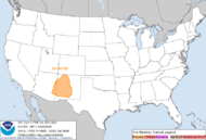
Today's Outlook  |
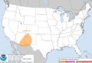
Tomorrow's Outlook  |
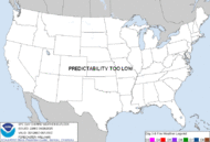
Day 3-8 Outlook  |
|
|
|
Month 1 Outlook  |
Month 2 Outlook  |
Month 3 Outlook  |
|
|
Fire Weather Warnings, and Watches |
|
Map and data courtesy of #FireMappers. Learn more about #FireMappers here.
This map is not a source of official information. Do not use this map to make important decisions that could result in harm to life or property. Always follow the instructions of local law enforcement and officials. This map is intended only to provide a general awareness of wildfire activity. For official information regarding the incidents shown on the map, please visit VCEmergency.com. |
|
|
|
|
Ten new large fires were reported in the past week. Currently, four large uncontained wildfires are burning in Virginia, Arizona, and Colorado. Wildland firefighters and support personnel contained 9 large fires this week. For a look ahead, check out the National Significant Wildland Fire Potential Outlook for seven-day and monthly outlooks generated by predictive services within the National Interagency Coordination Center. As April comes to a close, it is becoming warmer and drier nationwide. Make sure to include simple fire safety considerations for your home in your spring cleaning - especially if you live in or near wildlands. Examples include cleaning plant litter from your roof and gutters, removing flammable materials that are in contact with the exterior of your home, placing 1/8" mesh over vents in the eaves to protect them from the threat of flying embers, and breaking up continuous fuels in landscaping around your home. |
|
| Please check the IMSR for more information. |
|
| National Weather: April 26, 2024 |
|
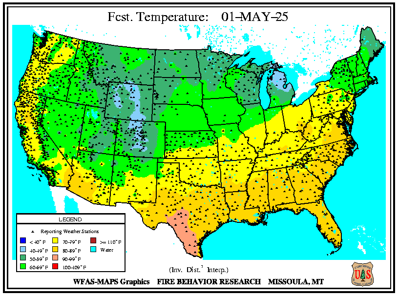
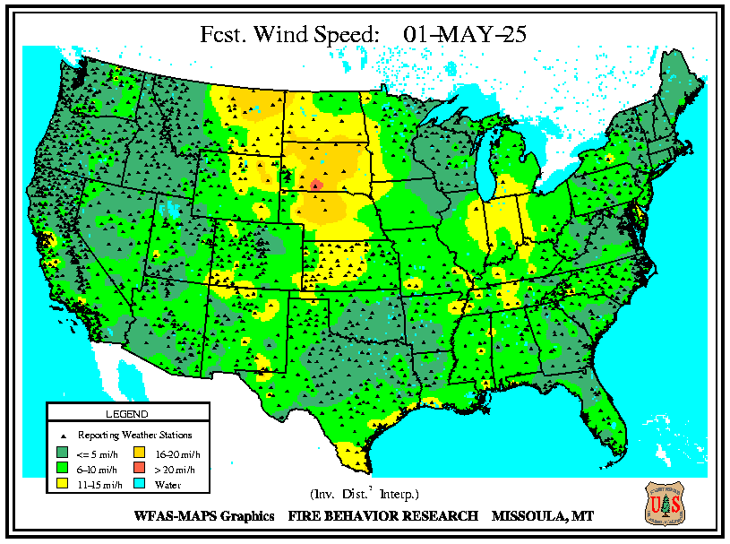
Strong southwesterly winds will continue across much of New Mexico into portions of the central/southern High Plains, with widespread critical conditions into Saturday and possibly Sunday. A storm across the central Plains will slowly move into the western Great Lakes this weekend with severe thunderstorms and heavy rainfall for much of the eastern Plains into the Lower/Mid-Mississippi Valley. Widespread wetting rain is forecast for much of the northern Plains into the western Great Lakes as well. The storm will weaken as it moves east with light to moderate rain for the Appalachians, Mid-Atlantic, and Northeast early to mid-next week. However, much of the Southeast will remain dry, with several days of minimum relative humidity below 35% possible for South Georgia and Florida. Across the West, a deep upper trough will bring widespread showers and high elevation snow to the much of the West through the weekend. As the storm emerges onto the Plains, more showers and thunderstorms are likely across much of the central and southern Plains mid to late next week, including portions of the High Plains. Fast- moving storms are then likely to track across the northern third of the West next week with periods of light precipitation, but much of the Great Basin, California, and Southwest will return to drier conditions with periods of breezy conditions. A cooling trend is forecast across much of Alaska this weekend into next week with temperatures returning to normal, but any precipitation that occurs will be light. For Hawai’i, moderate trade winds and generally dry conditions are expected into mid-next week. National Predictive Services Outlook 6 Minutes for Safety: The 6 Minutes for Safety topic of the day is Working With Helicopter Drops. |
|
|
| Local Weather: Saturday, April 27, 2024 - 2:10am PDT |
|
Another weather system will brush far northern California today
bringing a chance for a few showers to the northern mountains this
afternoon and evening. Otherwise, a trend toward dry and gradually
milder weather is expected into the middle of next week. Locally
breezy at times. [ More ] |
|
|
|
|
|
Lightning Ignited Fires |
|
|
National Interagency Fire Center statistics show
that in 2002-2006, an average of 12,000 (16%) of
the wildland fires were started by lightning per
year. These fires burned an average of 5.2 million
acres per year.
|
|
Two-thirds of lightning fires occur June-August. lightning fires peak in the late afternoon and early evening. Three-fifths
(61%) of all fires started by lightning occurred between 2:00 and 10:00 p.m.
55% of lightning fires occur outdoors, and 41% occur in
structures. Deaths and injuries occur mostly in structures
(89% and 86%, respectively).
Because most lightning fires occur outdoors, the most prominent form of material ignited is
"growing living form," which includes trees, brush, and grass.
Materials found on residential structures that are commonly ignited include roofs, sidewalls,
and framing. Electrical wiring is another material often ignited, as the electrical current in
lightning is drawn to electrical wires.
Civilians suffer more injuries than fatalities in lightning fires each year. Most casualties result from
lightning structure fires rather than outside or other types of lightning fires. 89% of lightning
fire civilian fatalities and 86% of injuries occur in structure fires.
|
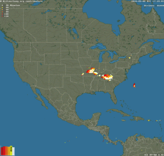
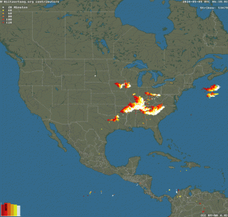
| Current Lightning Map (click to enlarge) |
|
|
|
Potential Outlook Maps |
|
(click for more info)
|
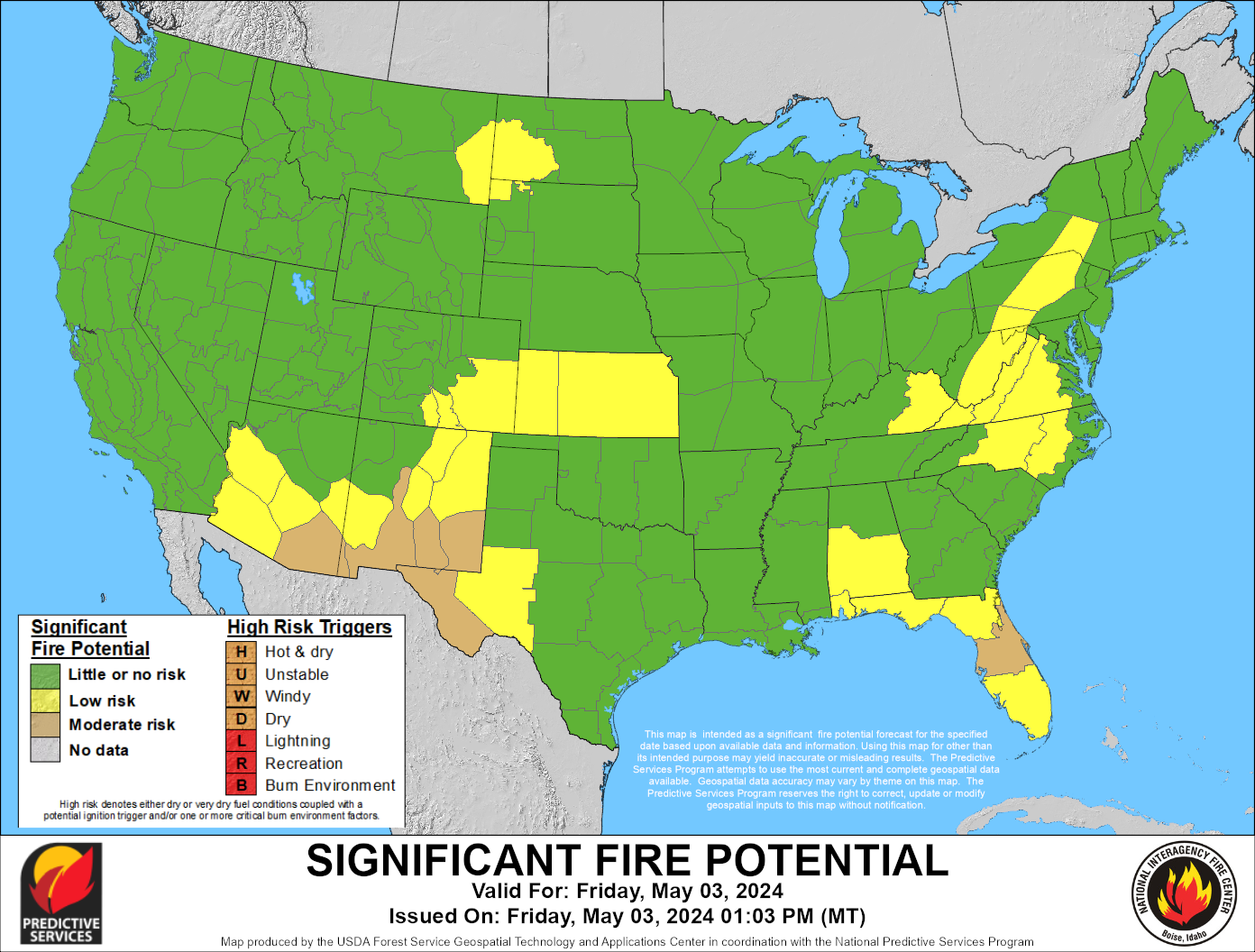
| Lightning Probability Forecast Map |
(click to enlarge)
|
|
|
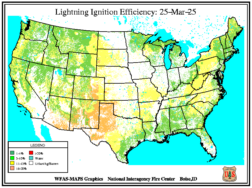
Lightning Ignition Efficiency |
|
Lightning fires are started by strikes to ground that have a component called a continuing current. All positive discharges have a continuing current, and about 20% of negative discharges have one. Ignition depends on the duration of the current and the kind of fuel the lightning hits. Ignition in fuels with long and medium length needle cast, such as Ponderosa pine and Lodgepole pine, depend on the fuel moisture. Ignitions in short- needled species, such as Douglas fir depend far more on the depth of the duff layer than on the moisture. Spread of the fire after ignition usually depends on fuel moisture in all cases.
|
|
The ignition efficiency on a 1 km pixel is given on a per discharge basis. That is, if the efficiency is high, then about 9 discharges will result in one ignition; if the efficiency is extreme, about 5 or fewer discharges will result in an ignition. The ratio of positive and negative discharges is built into the calculation. (Latham and Schlieter 1989) document the algorithm.
The fuel type and depth are conversions of the 1 km resolution current cover type (Hardy and others 1999) for this specific calculation. The moisture input is the 100-hr dead fuel moisture.
August 2002 - The lightning ignition efficiency algorithm has been corrected due to discovery of an error. The resulting maps reflect higher lightning efficiency than previously.
|
| Current Lightning Efficiency Map |

|
|
|
|
|
|
Haines Index (Wildfire Potential) |
|
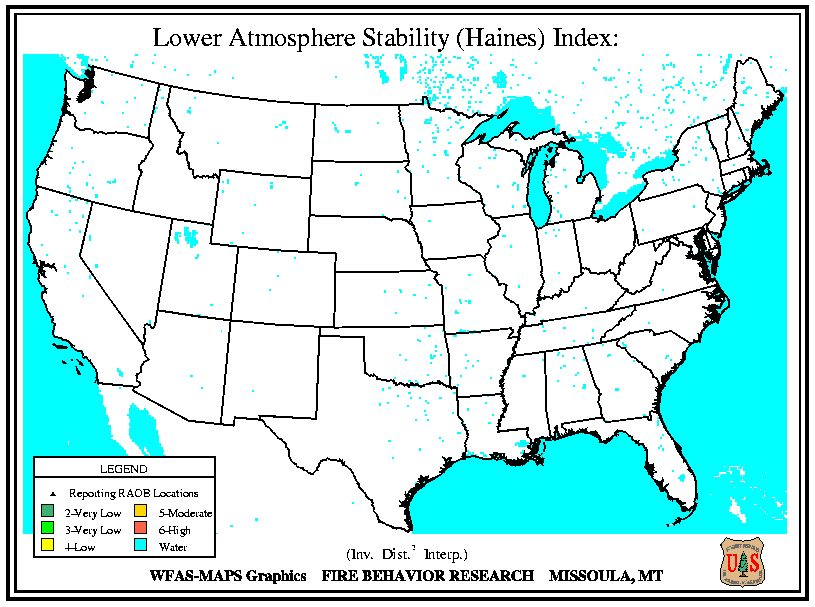
Haines (1988) developed the Lower Atmosphere Stability Index,
or Haines Index, for fire weather use. It is used to indicate the potential for wildfire growth by measuring the stability and dryness of the air over a fire.
It is calculated by combining the stability and moisture content of the lower atmosphere into a number that correlates well with large fire growth.
The stability term is determined by the temperature difference between two atmospheric layers; the moisture term is determined by the temperature and dew point difference.
This index has been shown to be correlated with large fire growth on initiating and existing fires where surface winds do not dominate fire behavior.
|
|
Haines Index is computed from the morning (12Z) soundings from RAOB stations across North America.
The Haines Index can range between 2 and 6. The drier and more unstable the lower atmosphere is, the higher the index.
- 2 : Very Low Potential -- (Moist Stable Lower Atmosphere)
- 3 : Very Low Potential
- 4 : Low Potential
- 5 : Moderate Potential
- 6 : High Potential ------ (Dry Unstable Lower Atmosphere)
|
Current Haines Index Map
 |
|
|
Fire Danger Maps |
|
|
|
|
|
Keetch-Byram Drought Index |
|
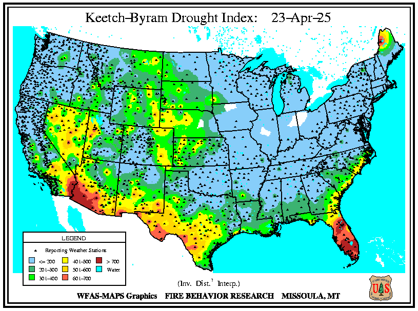
Keetch and Byram (1968) designed a drought index specifically for fire potential assessment.
It is a number representing the net effect of evapotranspiration and precipitation in producing cumulative moisture deficiency in deep duff and upper soil layers. It is a continuous index, relating to the flammability of organic material in the ground.
The KBDI attempts to measure the amount of precipitation necessary to return the soil to full field capacity.
|
It is a closed system ranging from 0 to 800 units and represents a moisture regime from 0 to 8 inches of water through the soil layer. At 8 inches of water, the KBDI assumes saturation. Zero is the point of no moisture deficiency and 800 is the maximum drought that is possible.
At any point along the scale, the index number indicates the amount of net rainfall that is required to reduce the index to zero, or saturation.
The inputs for KBDI are weather station latitude, mean annual precipitation, maximum dry bulb temperature, and the last 24 hours of rainfall. Reduction in drought occurs only when rainfall exceeds 0.20 inch (called net rainfall). The computational steps involve reducing the drought index by the net rain amount and increasing the drought index by a drought factor.
|
Current - Keetch-Byram Drought Index
 |
- KBDI = 0 - 200: Soil moisture and large class fuel moistures are high and do not contribute much to fire intensity. Typical of spring dormant season following winter precipitation.
- KBDI = 200 - 400: Typical of late spring, early growing season. Lower litter and duff layers are drying and beginning to contribute to fire intensity.
- KBDI = 400 - 600: Typical of late summer, early fall. Lower litter and duff layers actively contribute to fire intensity and will burn actively.
- KBDI = 600 - 800: Often associated with more severe drought with increased wildfire occurrence. Intense, deep burning fires with significant downwind spotting can be expected. Live fuels can also be expected to burn actively at these levels.
|
|
|
|
|
Information courtesy of ...
|
Local Fire Links
|
|
|
|
|


 41.2°F 95%
CBI: -2


 Air Quality