
- Home
- Forecast
- Radar
- Maps
- WX-Data
- WX-Misc.
- Astronomy
- Fire
- About
- Links
 Air Quality
EXTENDED WARNING: Geomagnetic K-index of 4 expected
| Weather Conditions Clear skies, Dry Visibility: 10 miles |
|
|
This Icon is a Combination of Blue Canyon Airport and Data From foresthillweather.com |
|


")

| Advisories / Alerts |
| Severe Wx Summary! | ||||||||
 |
||||||||
|
||||||||
|
||||||||
 |
||||||||
| Sat, Apr 27, 2024 - 5:11am | ||||||||
|
|
|
|
|
|
Info Links

| All Sky Moon Shadow | |||
|
|||
2024 April 27 |
|||
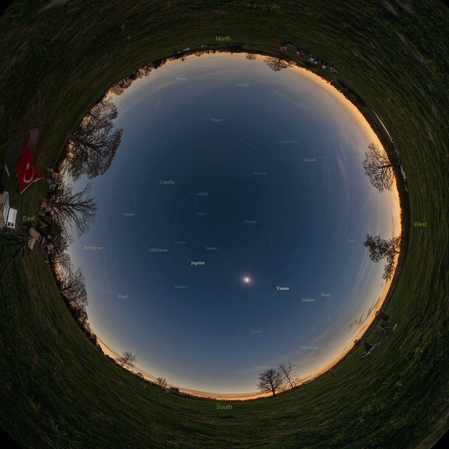
Explanation: If the Sun is up but the sky is dark and the horizon is bright all around, you might be standing in the Moon's shadow during a total eclipse of the Sun. In fact, the all-sky Moon shadow shown in this composited panoramic view was captured from a farm near Shirley, Arkansas, planet Earth. The exposures were made under clear skies during the April 8 total solar eclipse. For that location near the center line of the Moon's shadow track, totality lasted over 4 minutes. Along with the solar corona surrounding the silhouette of the Moon planets and stars were visible during the total eclipse phase. Easiest to see here are bright planets Venus and Jupiter, to the lower right and upper left of the eclipsed Sun. |
|||
| High Resolution Image | |||
| Tomorrow’s Image: rings around the ring | |||
| Credit & Copyright: Tunc Tezel (TWAN) | |||
| Courtesy of Astronomy Picture of the Day Index - Main Page & Astronomy Picture of the Day | |||


Ambient Weather VWS v14.00 Weather-Display (10.37S-(b58))
Virtual VP software Top Website Map Copyright © 2007 - 2024 Foresthillweather.com Never base important decisions on this or any weather information obtained from the Internet