

Space WX Alerts:
( Latest Alert ) - Issue Time: 2024 Apr 26 2300 UTC
39.7°F
Light air
Updated:
4/27/24 4:49am

| Advisories / Alerts |
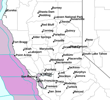
| Severe Wx Summary! | ||||||||
 |
||||||||
|
||||||||
|
||||||||
 |
||||||||
| Sat, Apr 27, 2024 - 4:41am | ||||||||
|
|
|
|
|
|
Info Links
NOAA Image of the day
| NOAA Confirms Fourth Global Coral Bleaching Event | |||
|
|||
April 26, 2024 |
|||
The world is currently experiencing a global coral bleaching event, according to NOAA scientists. This is the fourth global event on record and the second in the last 10 years. Bleaching-level heat stress, as remotely monitored and predicted by NOAA’s Coral Reef Watch (CRW), has been—and continues to be—extensive across the Atlantic, Pacific and Indian Ocean basins. CRW's heat-stress monitoring is based on sea surface temperature data, spanning 1985 to the present, from a blend of NOAA and partner satellites. |
|||
| High Resolution Image | |||
| Courtesy of NOAA National Environmental Satellite, Data, and Information Service (NESDIS) | |||
powered by Cumulus v1.9.3 (1059)
Ambient Weather VWS v14.00 Weather-Display (10.37S-(b58))
Virtual VP software Top Website Map Copyright © 2007 - 2024 Foresthillweather.com Never base important decisions on this or any weather information obtained from the Internet
Ambient Weather VWS v14.00 Weather-Display (10.37S-(b58))
Virtual VP software Top Website Map Copyright © 2007 - 2024 Foresthillweather.com Never base important decisions on this or any weather information obtained from the Internet
 Air Quality


