
- Home
- Forecast
- Radar
- Maps
- WX-Data
- WX-Misc.
- Astronomy
- Fire
- About
- Links
 Air Quality
Space WX Alerts:
( Latest Alert ) - Issue Time: 2024 Apr 26 0451 UTC
WARNING: Geomagnetic K-index of 4 expected
 |
Weather Conditions Overcast, Light Rain Cloud ht: 300 ft Visibility: 1 1/2 miles |
| Todays Rain 0.09 in | |
|
This Icon is a Combination of Blue Canyon Airport and Data From foresthillweather.com |
|
44.5°F
Calm
Updated:
4/26/24 5:04am


")

| Advisories / Alerts |
| Severe Wx Summary! | ||||||||
 |
||||||||
|
||||||||
|
||||||||
 |
||||||||
| Fri, Apr 26, 2024 - 5:01am | ||||||||
|
|
|
|
|
|
Info Links

National Weather Service - Severe Weather Summary
|
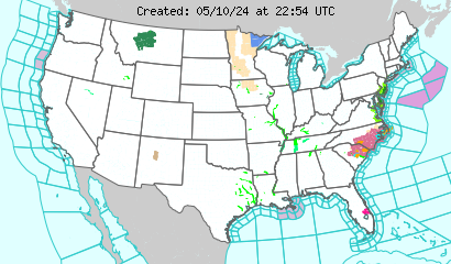
Latest U.S. Weather Alerts
 Click Map Region to Display Local Forecast Office Map Below
|
||
Weather Forecast Office
|
|
|


Local Warnings and Advisory Last Update: 1:31 am PDT Apr 26, 2024 |
5 Miles SE Tahoe City CA 39.1°N 120.09°W (Elev. 6227 ft) |
There are no Warnings or Advisorys at this location at this time |
7 Day Forecast 5 Miles SE Tahoe City CA 39.1°N 120.09°W (Elev. 6227 ft) |
||||||||
Overnight Rain/Snow Likely |
Friday Rain/Snow Likely |
Friday Night Chance Rain/Snow then Partly Cloudy |
Saturday Sunny |
Saturday Night  Partly Cloudy |
Sunday Sunny |
Sunday Night  Mostly Clear |
Monday Sunny |
Monday Night  Clear |
| Lo: 36 °F | Hi: 42 °F | Lo: 30 °F | Hi: 51 °F | Lo: 35 °F | Hi: 55 °F | Lo: 37 °F | Hi: 58 °F | Lo: 39 °F |
|
Overnight
Rain and snow showers likely. Snow level 6400 feet. Mostly cloudy, with a low around 36. West wind around 10 mph. Chance of precipitation is 70%. Little or no snow accumulation expected.
Friday
Rain and snow showers likely before 11am, then snow showers likely between 11am and 2pm, then rain and snow showers likely after 2pm. Some thunder is also possible. Snow level 6300 feet. Mostly cloudy, with a high near 42. West wind around 10 mph. Chance of precipitation is 70%. Little or no snow accumulation expected.
Friday Night
A chance of rain and snow showers, mainly before 8pm. Partly cloudy, with a low around 30. North wind 5 to 10 mph. Chance of precipitation is 30%. Little or no snow accumulation expected.
Saturday
Sunny, with a high near 51. Light northwest wind becoming west 5 to 10 mph in the afternoon.
Saturday Night
Partly cloudy, with a low around 35. West wind 5 to 10 mph.
Sunday
Sunny, with a high near 55. Light southwest wind becoming west 5 to 10 mph in the afternoon.
Sunday Night
Mostly clear, with a low around 37.
Monday
Sunny, with a high near 58.
Monday Night
Clear, with a low around 39.
Tuesday
Sunny, with a high near 60.
Tuesday Night
Clear, with a low around 41.
Wednesday
Sunny, with a high near 61.
Wednesday Night
Mostly clear, with a low around 43.
Thursday
Sunny, with a high near 57.
|
|


powered by Cumulus v1.9.3 (1059)
Ambient Weather VWS v14.00 Weather-Display (10.37S-(b58))
Virtual VP software Top Website Map Copyright © 2007 - 2024 Foresthillweather.com Never base important decisions on this or any weather information obtained from the Internet
Ambient Weather VWS v14.00 Weather-Display (10.37S-(b58))
Virtual VP software Top Website Map Copyright © 2007 - 2024 Foresthillweather.com Never base important decisions on this or any weather information obtained from the Internet