National Weather Service - Severe Weather Summary

National Warnings and Weather Alerts


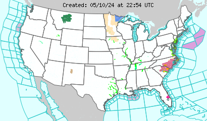
Latest U.S. Weather Alerts
Cmap
Click Map Region to Display Local Forecast Office Map Below


Latest Regional Wx Alerts
Local Warnings and Advisory


Local Warnings and Advisory
Last Update: 5:21 pm PDT May 2, 2024
12 Miles E Meadow Vista CA
 39.02°N 120.82°W (Elev. 2812 ft)


Tonight: Clear, with a low around 49. West northwest wind 5 to 8 mph becoming calm  in the evening.
ClearFriday: Sunny, with a high near 70. Calm wind becoming west southwest 5 to 8 mph in the afternoon.
SunnyFriday Night: Increasing clouds, with a low around 45. Southwest wind around 6 mph becoming light and variable.
Increasing
CloudsSaturday: Showers. The rain could be heavy at times.  High near 50. South southwest wind 8 to 11 mph, with gusts as high as 18 mph.  Chance of precipitation is 90%. New precipitation amounts between 1 and 2 inches possible.
Heavy RainSaturday Night: Showers likely and possibly a thunderstorm before 11pm, then a slight chance of showers.  Mostly cloudy, with a low around 36. South southwest wind 6 to 10 mph.  Chance of precipitation is 60%.
Showers
Likely then
Slight Chance
ShowersSunday: Mostly sunny, with a high near 51.
Mostly SunnySunday Night: Mostly clear, with a low around 37.
Mostly ClearMonday: Sunny, with a high near 59.
SunnyMonday Night: Mostly clear, with a low around 42.
Mostly Clear

Tonight: Clear, with a low around 49. West northwest wind 5 to 8 mph becoming calm  in the evening.

Friday: Sunny, with a high near 70. Calm wind becoming west southwest 5 to 8 mph in the afternoon.

Friday Night: Increasing clouds, with a low around 45. Southwest wind around 6 mph becoming light and variable.

Saturday: Showers. The rain could be heavy at times.  Hi near 50. South southwest wind 8 to 11 mph, with gusts as high as 18 mph.  Chance of precipitation is 90%. New precipitation amounts between 1 and 2 inches possible.

Saturday Night: Showers likely and possibly a thunderstorm before 11pm, then a slight chance of showers.  Mostly cloudy, with a low around 36. South southwest wind 6 to 10 mph.  Chance of precipitation is 60%.

Sunday: Mostly sunny, with a high near 51.

Sunday Night: Mostly clear, with a low around 37.

Monday: Sunny, with a high near 59.

Monday Night: Mostly clear, with a low around 42.

7 Day Forecast
12 Miles E Meadow Vista CA
 39.02°N 120.82°W (Elev. 2812 ft)
TonightFridayFriday NightSaturdaySaturday NightSundaySunday NightMondayMonday Night
Lo: 49 °FHi: 70 °FLo: 45 °FHi: 50 °FLo: 36 °FHi: 51 °FLo: 37 °FHi: 59 °FLo: 42 °F
Tonight
Clear, with a low around 49. West northwest wind 5 to 8 mph becoming calm in the evening.
Friday
Sunny, with a high near 70. Calm wind becoming west southwest 5 to 8 mph in the afternoon.
Friday Night
Increasing clouds, with a low around 45. Southwest wind around 6 mph becoming light and variable.
Saturday
Showers. The rain could be heavy at times. High near 50. South southwest wind 8 to 11 mph, with gusts as high as 18 mph. Chance of precipitation is 90%. New precipitation amounts between 1 and 2 inches possible.
Saturday Night
Showers likely and possibly a thunderstorm before 11pm, then a slight chance of showers. Mostly cloudy, with a low around 36. South southwest wind 6 to 10 mph. Chance of precipitation is 60%.
Sunday
Mostly sunny, with a high near 51.
Sunday Night
Mostly clear, with a low around 37.
Monday
Sunny, with a high near 59.
Monday Night
Mostly clear, with a low around 42.
Tuesday
Sunny, with a high near 64.
Tuesday Night
Mostly clear, with a low around 44.
Wednesday
Sunny, with a high near 67.
Wednesday Night
Mostly clear, with a low around 47.
Thursday
Sunny, with a high near 69.


NOAA NWS Severe Weather Outlook
Current Weather Watches
Mesoscale Discussions
Current Mesoscale Discussions
Thunderstorm Outlook
Convective Outlooks
Today's Outlook
Day 1 Convective Outlook graphic and text
Tomorrow's Outlook
Day 2 Convective Outlook graphic and text
Day 3 Outlook
Day 3 Convective Outlook graphic and text
Fire Weather Outlooks
Today's Outlook
Day 1 Fire Weather Outlook graphic and text
Tomorrow's Outlook
Day 2 Fire Weather Outlook graphic and text
Day 3-8 Outlook
Day 3-8 Fire Weather Outlook graphic and text
Data courtesy of National Weather Service
NWS map Southern Florida Newport/Morehead City, NC Brownsville, TX Corpus Christi, TX Houston/Galveston, TX New Orleans, LA Lake Charles, LA Mobile, AL Tallahassee, FL Tampa, FL Miami, FL Key West, FL Florida Keys Miami, FL Jacksonville, FL Charleston, SC Wilmington, NC Baltimore/Washington, DC Wakefield, VA Philadelphia/Mt. Holly, PA/NJ New York, NY Boston, MA Gray/Portland, ME Caribou, ME Northern Michigan San Diego, CA San Francisco Bay Area/Monterey, CA Eureka, CA Medford, OR Portland, OR Seattle, WA Los Angeles Area Los Angeles Area Los Angeles Area Los Angeles Area Los Angeles Area Los Angeles Area South Central California San Francisco Area Western Nevada North Central California Northwest California Coast Southwest Oregon and Northern California Northeast Oregon and Southeast Washington Northwest Oregon Northwest Washington Eastern Washington and Northern Idaho Southern Nevada, Southeastern California and Northwestern Arizona - Las Vegas Southwestern California - San Diego Central Arizona and California Deserts Southeast Arizona Northern Arizona Utah Northern and Northeastern Nevada Southwestern Idaho and Eastern Oregon Southeastern Idaho Western Montana and Central Idaho Central Montana - Great Falls Northeastern Montana Southeastern Montana Western Wyoming Southeastern Wyoming and Western Nebraska Northeastern Colorado Western Colorado and Eastern Utah Southeastern Colorado Northern and Central New Mexico Southern New Mexico and extreme Western Texas - El Paso Texas and Oklahoma Lubbock and South Plains Texas Western Texas and Southeastern New Mexico Western South Dakota and Northeastern Wyoming Northwestern Kansas and East Central Colorado - Goodland Central Nebraska - North Platte North Central Kansas and South Central Nebraska Southeastern South Dakota, Southwestern Minnesota, and Northwestern Iowa Northern and Northeastern South Dakota Western North Dakota Eastern Nebraska and Southwestern Iowa - Omaha Valley Northeastern Kansas Southeastern Kansas Southwestern Kansas - Dodge City Central Oklahoma Dallas and Fort Worth Central Texas - San Angelo Austin and San Antonio Texas Corpus Christi, Victoria, and Laredo Texas Southern Texas Texas - Houston/Galveston Southeast Texas and Southwest Louisiana Northern Louisiana and Eastern Texas - Shreveport Arkansas Southwestern Missouri Northwestern Missouri Central Iowa Southern Minnesota Northeastern North Dakota and Northwestern Minnesota Northeast Minnesota and Northern Wisconsin Southwestern Wisconsin, Southeastern Minnesota, and Northeast Iowa Eastern Iowa and Northwestern Illinois - Quad Cities Eastern Missouri - West Central Illinois Western Tennessee, Eastern Arkansas and Northern Mississippi - Memphis Central Mississippi Southeastern Louisiana Middle Tennessee Northern Alabama Central Alabama Mobile - Pensacola West Central Florida East Central Florida Panhandle of Florida and Southwestern Georgia Northeast Florida and Southeast Georgia Northern and Central Georgia Low Country of South Carolina and Georgia Northeastern South Carolina and Southeastern North Carolina - Wilmington Central South Carolina and CSRA Western North Carolina and Northwest South Carolina Eastern Tennessee Eastern Kentucky Central Kentucky Southern Illinois and Indiana, Southeastern Missouri and Western Kentucky Central and East Central Illinois Central Indiana Northeastern Illinois and Northwestern Indiana - Chicago Southern and Southeastern Wisconsin East Central Wisconsin - Green Bay Northern Michigan Northeast Michigan - Gaylord Northeast Michigan - Gaylord Southeastern Michigan - Detroit Southwestern Michigan Northern Indiana and Northwestern Ohio Southwestern Ohio Northern Kentucky West Virginia Western Virginia, Southeast West Virginia, and Northwest North Carolina Central North Carolina - Raleigh Eastern North Carolina Eastern Virginia, Southern Maryland and Northeast North Carolina Washington D.C., Central Maryland, Northern Virginia, Eastern West Virginia Western Pennsylvania, East Central Ohio and Extreme Western Maryland Northern Ohio Central Pennsylvania New Jersey, Delaware, and Southeastern Pennsylvania New York City and Surrounding Areas South Central New York and Northeastern Pennsylvania Western New York - Buffalo Eastern New York and Western New England Areas Boston and Surrounding Areas Northern Vermont and New York Southern Maine and New Hampshire Northern Maine
powered by Cumulus v1.9.3 (1059)
Ambient Weather VWS v14.00
Weather-Display (10.37S-(b58))
Virtual VP software
Top Website Map Copyright © 2007 - 2024 Foresthillweather.com Never base important decisions on this or any weather information obtained from the Internet